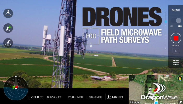
Drones for Field Microwave Path Surveys
Telecommunication customers live in a world of service reliability – one where they compute an outage in seconds, quickly understanding the difference between a 99.999 and a 99.995 microwave design. They rationalize economic trade-offs and proceed to deploy the solution that fits. However, before making this decision, much time, effort and cost is spent in the pre-deployment phase, addressing such areas as site selection, microwave design, field validation, licensing, zoning and permitting.
In a traditional MW design approach – using electronic desktop validation tools – a network design can deliver an 80-90% success rate. Said another way, for every 10 MW links designed, only 1 or 2 would fail the field Line of Sight (LoS) survey.
Traditional Approach - Desktop Design and Electronic Line of Sight (if available) Approach
- Customer provides:
- GPS co-ordinates of site(s) – invest time and energy to determine what mounting locations are available for monthly leasing, costs associated, etc.
- Mounting height and building type
- Design requirements: throughput, SLA, antenna size limitations etc.
- DragonWave delivers:
- Electronic line of sight surveys on potential path and completes engineering analysis in a microwave transmission tool. Results are shared with the client.
- Outcome
- Customer Benefits – low cost
- Customer Limitations – customers may provide “ideal” candidate locations with no AZP (Access, Zoning, Permitting) knowledge/research, low probability site will be available. DW/OEM Limitations – lower conversion rate from microwave design to installation.
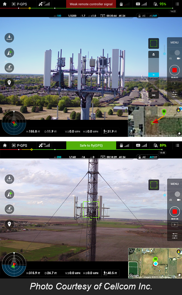
In an effort to deliver a higher reliable network, the DragonWave services team has been forming partnerships with drone professionals in the industry. Going beyond the drone hobbyist, drone surveys require > $5K drone technology with back end support to post process the imagery and video within 24 hours of flight. They must also be able to stream the video/data content directly to the DW microwave engineer in minutes. This allows any blocked paths to be identified immediately, allowing the DragonWave Microwave Engineer to provide real time azimuth changes to the drone operator. This streamlined approach ensures that a potential leasing candidate site has at minimum one validated LoS path. If no paths are clear, the field data will identify alternative candidate sites in the customer’s Area of Interest.
Additionally, this data is valuable for:
- RF engineers to understand vertical real estate available and to evaluate down tilts, interference, etc.
- Construction groups for creating accurate material BOM's.
- Landlords or MLAs to identify discrepancies in CD’s and for supporting as-builts.
Desktop and Electronic Line of Sight with Drone Approach:
- Customer provides:
- GPS co-ordinates of site(s) or Area of Interest (AOI) for coverage area is defined, and identify any landlord preferences or limitations.
- Design requirements: throughput, SLA, antenna size limitations etc.
- DragonWave delivers:
- Electronic line of sight surveys on potential path and completes engineering analysis in a microwave transmission tool.
- Drone used to perform deployment feasibility analysis of site and proposed paths – field validated with high resolution photo’s and video.
- Customer Benefits - Provides current view of equipment on proposed site and/or possible location, able to identify # of antenna’s that could be mounted at specific heights, and what mounting height(s) would be required. Eliminates wasted time negotiating access to sites which can never be used in the MW design based on antenna availability and Line of Sight availability.
- Customer Limitations – Increased upfront investment (due to field visit) and time associated with scheduling and performing the work.
- Drone requirements – high resolution photo’s 5280x3956 at 20.8mp, 360 panoramic at 6 heights defined by MW engineer, and entire flight would need video captured with flight data gauge (compass, elevation, flight location)
- X and Y co-ordinates , location, elevation recorded included as watermark and added to each photo
There is a market for using drones in networking engineering designs given customers understand the economic benefits, and the higher upfront cost that provides insurance that there are no later deployment surprises/headaches. DragonWave has seen a high variation in pricing on drone site survey and LOS by geographic market. The cost is largely based on the number of sites, their deployment density (distance between), their location (geographic) distance from the Drone operator, and the commercialization of the Drone operator (back end support).
With the example above, with the Non Drone approach, 3 Flash LoS surveys would need to be performed – two initially on flagged paths in the design and 1 more to determine an alternative for a blocked path – versus 10 drone surveys – site survey, 360 panoramic, video capture etc. Based on DragonWave’s experience, using drones is on average 20% cheaper on survey costs, and is able to be completed much earlier in the planning process. With that in mind, operators might strongly want to consider utilizing drones in their next network design.
If I'm reading this article right, then this isn't a "microwave path survey". It's just using a drone to fly the towers at the terminal points to flash the path to see if there's any direct blockage to LOS. It doesn't mention documenting the internal path itself - just providing photos of the path from the tower site.
There are many more considerations to properly designing a MW path than just LOS clearance using photos. This is another shortcut by companies who wish to design systems without paying a microwave path surveyor to actually physically verify and accurately document the path & path obstructions. Using guestimated designs from photos collected only at the terminal points, they apparently are willing to risk all sorts of mid-path physical issues that could affect feasibility and reliability.
Performing Line of Sight (LOS) surveys is still an afterthought with most customers deploying microwave. A high percentage of customers will leave the decision to the microwave engineer (MWE) to approve the path based on electronic path analysis. Unfortunately, the MWE has only enough budget to survey approx.. 70% of the paths (expect this is optimistic). Like identified in the comments – drone LOS surveys have limitations and using them on longer MW paths or where multipath fading or ducting issues are present should be field verified by a traditional approach. Fresnel infringements will lead to path performance issues and the installation team struggling to arrive within the +/- 3dB of calculated RSL. However, for the majority of customers, (trend for network intensification and shorter higher capacity MW links) being able to perform drone LOS on all of them and further finding the blocked paths as extremely beneficial.
With a recent customer – they reviewed the performance of the MWE team – on the 30% of approved electronic non surveyed paths, 3.1% of paths were found blocked during installation. On the remaining 70% that were submitted for Flash LOS survey, 1.7% had a blocked path and needed to go back into the MW design phase. The debate is now whether drone field surveys could have identified the 3.1% of blocked paths….saving the company time, money and engineering rework. Findings are to be continued…..
Is the a particular make/ model drone preference?
Hello Cody - thank you for the question - given the market for drone's the possibilities are limitless. Most serious drone operators/professionals tend to customize the parts on the drone. Our recomendation to general contractors entering into this service offering is to utilize a best of breed product like DJI Inspire 2.
hola podrian contactarme por el producto de drones
gracias
Hola David, Roberto estará en contacto con usted en breve para discutir.
Drones or unmanned aerial vehicles are aircraft either controlled by ‘pilots’ from the ground or a pre-programmed mission. All in all this was a great article/post and I liked it very much. I will bookmark your website and link to your post. We love seeing true dedication of article writing and we thank you for writing this story about drones. Please check out our page to see a wider range of drones reviewed http://topproducts.com/reviews/best-drone.htm
Nowadays drones are used in many sectors and they are the new way of doing things differently and perfectly. This article provided a good knowledge about the use of drones. http://www.theabsolutereviews.com/best-drones-with-camera-for-sale-2017/